Evia. Easy hiking trail in a fir forest

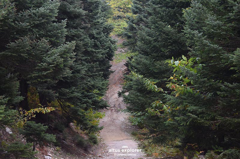
A beautiful and quite easy hiking route suitable for those who want to start or learn about hiking. The route can be started from the dirt road (see the first starting point on the premium map) through the fir forest with its distinctive rocky terrain!
The start of the trail is easy with very well trodden dirt for the most part, except for some spots with a few rocks without making your hike difficult.
Just before 2.5km the trail has a junction on the right which leads to the top of the mountain!
Many points overlooking the northeastern part of the mountain will be an excuse to relax and enjoy the forest landscape of the island.
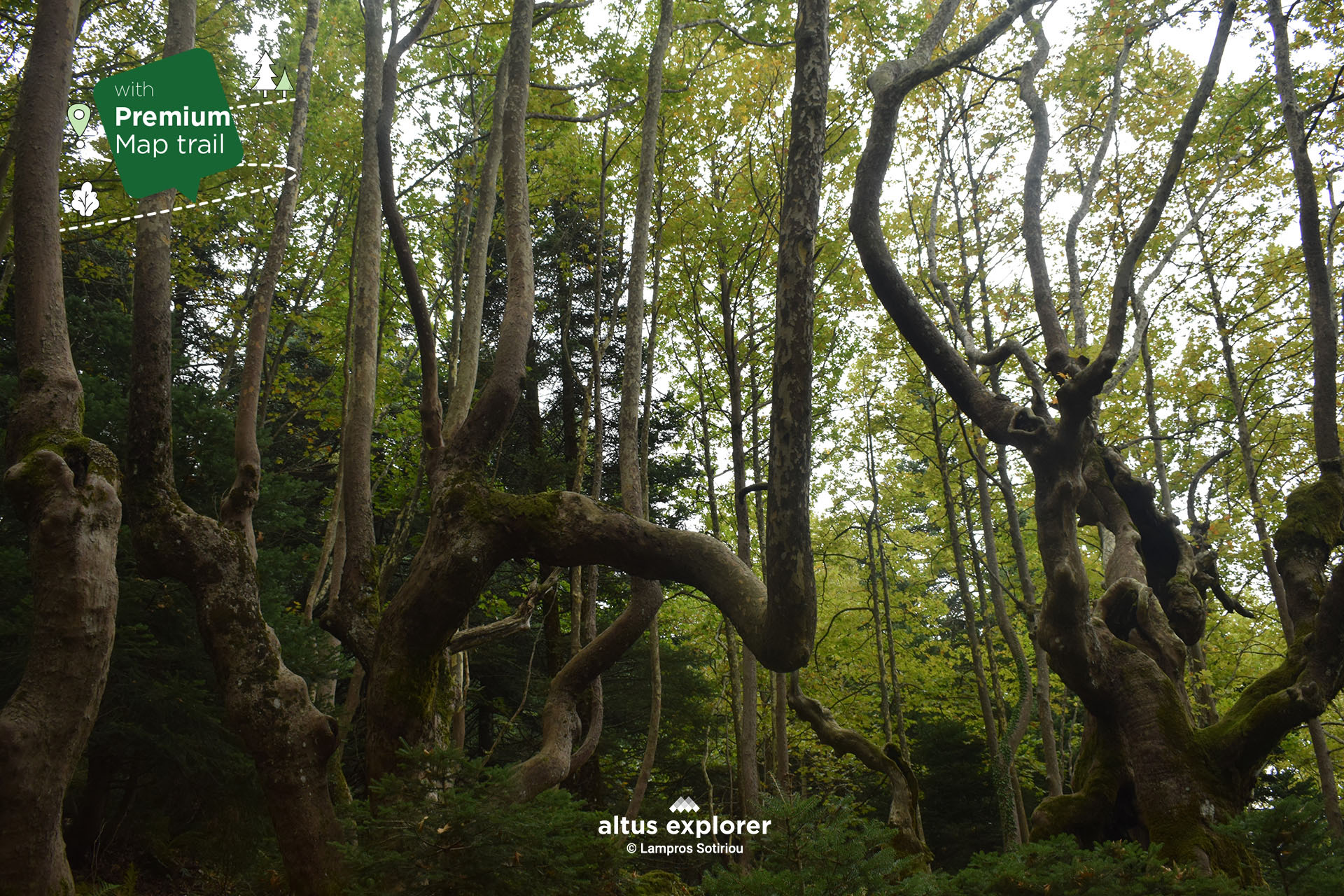
At the end of the route and arriving at the source Konisma with its impressive plane trees.... the landscape will surprise you!
On this hiking route you will see (available on activation of the premium version):
- More photos on most of the route(description & map)
- How to get to the trailhead or other points of interest by car(description & map)
- Where on the trail there is a straight route and how to get there. ( map)
- Places that will inspire you to take photos or videos(description & map)
Many points of interest such as with a view, relaxing in nature, vegetation(description & map)
![]()
 Forest road just before the beginning of the trail
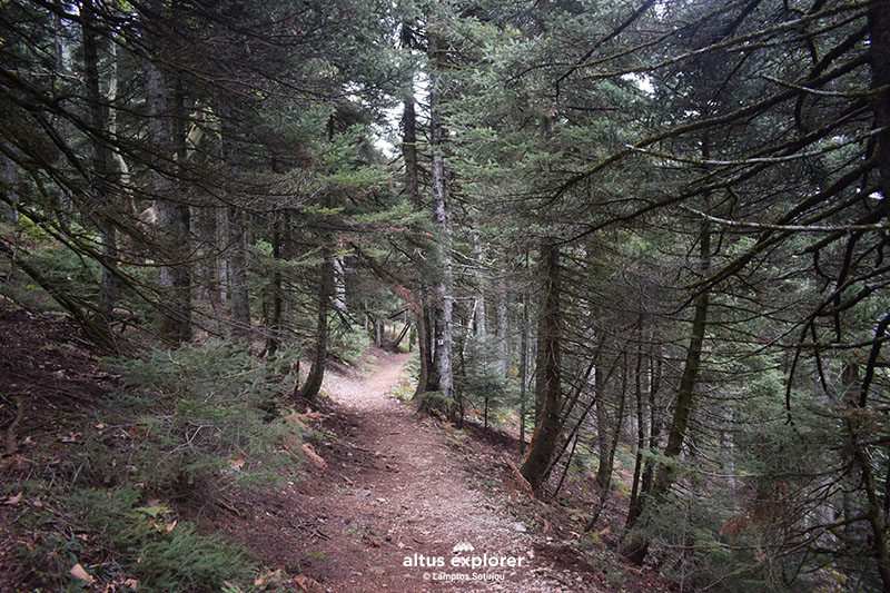 Beginning of the trail in the fir forest
![]()
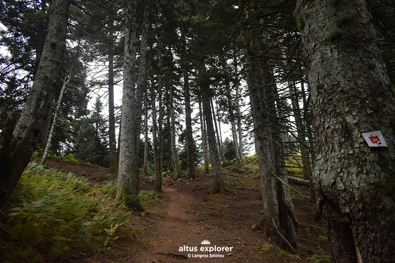 Short ascent on the path.
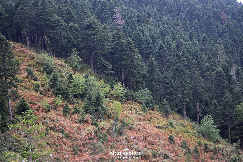 View to the fir forest

- Bring plenty of water and food (if you walk the whole route. Count on the return journey).
- If you walk it in the summer, check if there is a curfew.
- Do not walk on it during periods of very high temperatures.
Upon completion of your hike, the following are suggested:
• You can go for lunch at Steni Dirfyos Strait

Χάρτης διαδρομής - πεζοπορίας
Ξεκλειδώστε τον αναλυτικό χάρτη πεζοπορίας Permium αυτής της διαδρομής, τα επιπρόσθετα χαρακτηριστικά της, όπως και όλους τους Premium διαθέσιμους πεζοπορικούς χάρτες με μια συνδρομή.

1. Ο Premium πεζοπορικός χάρτης περιλαμβάνει τα παρακάτω χαρακτηριστικά (όποια υπάρχουν στη διαδρομή):
- Σημεία στη διαδρομή με ευθεία, με ανηφόρα (και με έντονο χρώμα), κατηφόρα.
- Σημεία στη διαδρομή με πέτρες (εφόσον υπάρχει)
- Σημεία φυσικού ενδιαφέροντος (με πυκνό δάσος, με δέντρα, χαμηλή βλάστηση, ποτάμια, καταρράκτες, σπηλιές, λίμνες κτλ)
- Εκτυπώστε τον χάρτη για backup (διαθέσιμο μόνο για μεγάλες διαδρομές)
- Σημεία γενικού ενδιαφέροντος (σημεία με θέα, πολιτιστικά μνημεία, αρχαιολογικοί χώροι, κτλ)
- Χιλιομετρικές αποστάσεις, σημεία έναρξης
- Σημεία ενδιαφέροντος με φωτογραφίες
- Catch eye points για φωτογράφιση και video
2. Επιπρόσθετα χαρακτηριστικά διαδρομής
- Download GPΧ
- Πως θα φτάσετε στο σημείο εκκίνησης
- Πλοηγηθείτε στον χάρτη με εντοπισμό της θέσης σας χωρις να κατεβάσετε εφαρμογή (ΒΕΤΑ - προσωρινά δοκιμαστική έκδοση)
Διαθέσιμος με συνδρομή
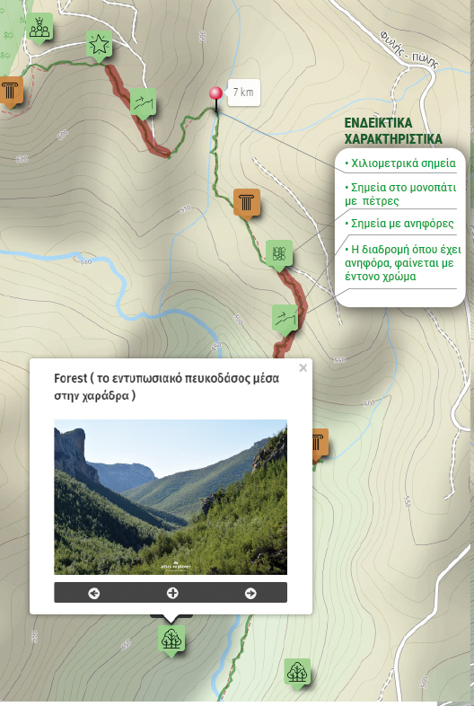
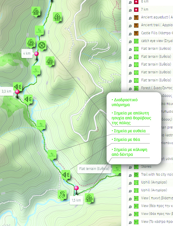
Η παρακάτω εικόνα είναι γενικό παράδειγμα experience map με καποια από τα χαρακτηριστικά του και όχι τμήμα της παρούσας διαδρομής.